Bear Creek (West) Multiple
-
RunBear Creek (West)
-
ClassI (II,VI)
-
Put InMill Creek Launch - Hwys 241/172
-
Take OutRock Quarry Branch Access - Hwy 172
-
Length (mi)7 (Mill to Rock Quarry) or more
-
Gradient (fpm)10'/mile
-
Watershed (mi2)110
-
Primary Gage
- TVA Upper Bear Creek Dam 210 cfs*
-
Indicator Gage
none
Description
Bear Creek is fed by dam releases from the Upper Bear Creek Dam, making it the only reliable summer whitewater in northern Alabama. Since it is low gradient drop/pool, it is definitely suitable for beginners. This would be a good place to start if you have no moving water experience and want a taste of whitewater in a scenic setting. Several sections can be run. Access is possible as high up as CR 5. You can take out as far down as Scott Bridge on Rt. 187. There is a good map at the Dismals Link above, check it out before you decide which part to run. This site also has a good description of the run, though their definition of class II may be a bit 'conservative'.
The section from CR 5 to Mill Creek access features Old Mill Falls, which is a runnable class III or III+ drop depending on your chosen line. The most popular trip is from Mill Creek to Rock Quarry. It starts off slow, picks up a bit, then is slow at the end. At about mile 2.5 is a nice class II slide with a wave at the top and bottom. A few hundred yards downstream is the well marked Factory Falls. Factory Falls would be a nice challenging IV if it wasn't for the pinning rock right in the middle of the drop. It is a must walk. The washout is amusing III. The whole run would perk up if TVA released 300 cfs or more, but the lake is small and the summers have been dry. The fishing is not bad.
Below Rock Quarry there is only a bit of current here and there until you reach Hwy 43. Then there is intermittent class I, with even a mellow wave or two. It is a nice scenic float down to Military Bridge that does not have much man made encroachment. The entire trip from CR 5 to Military bridge has been done in 7.5 hrs by some friends of mine, but they paddled fairly hard during the last section.
Commercial outfitters are available. Bear Creek Canoe Run outfitter (205) 993 4459, on US43 between Russelville and Hamilton at the creek is the most popular.
Bear Creek will also run when the lake is spilling. Keep in mind that the normal portage route over the rocks at Factory Falls may go underwater at about 700cfs. This should not present a problem for someone with whitewater experience or if you are used to getting out in a shore eddy or similar, but if you are looking for a casual float it could get dangerous.
* Call TVA to get release level, or see the gauge link above, usually every Saturday & Sunday and holiday Monday through October until lake level is 783'.
Details
-
ClassI (II,VI)
-
Gradient (fpm)10'/mile
-
Length (mi)7 (Mill to Rock Quarry) or more
-
Watershed Size (mi2)110
-
Put InMill Creek Launch - Hwys 241/172
-
Take OutRock Quarry Branch Access - Hwy 172
-
Shuttle241 / 172
-
Water Quality
 (
2 chickens | 1 = Good, 3 = Gross)
(
2 chickens | 1 = Good, 3 = Gross)
-
Primary Gage
- TVA Upper Bear Creek Dam 210 cfs*
-
Indicator Gage
-
Precip. Gage
Map
Video
Photos
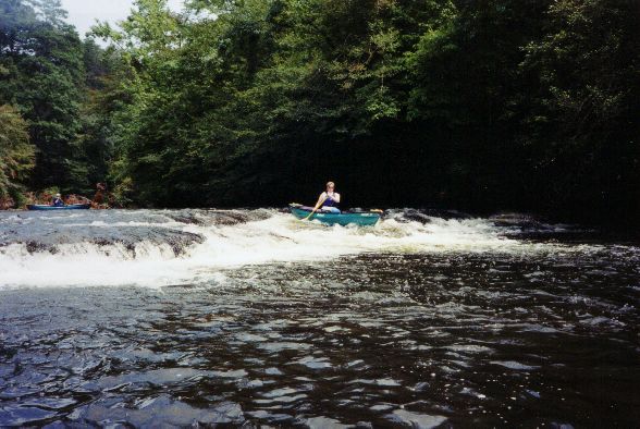
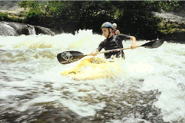
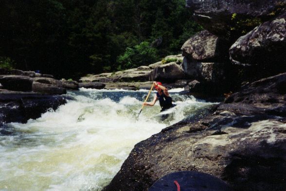
Outside of the big ones, this is about as good as it gets on Bear. Who is this lovely young lady and why is she not wearing a helmet? (Mary D' , Ben Fer (...)
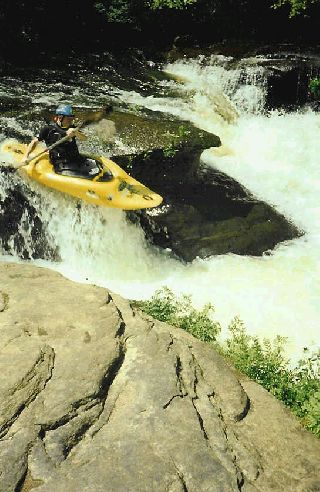
Boyd Ruppelt runnin� the Left falls of the middle slot of Old Mill Falls (photo courtesy Boyd Ruppelt)
Boyd runnin� the main route on Old Mill Falls�the middle-to-left line of the river left slot. (photo courtesy Boyd Ruppelt)
A trandom run of Old Mill Falls. Boyd runnin� the Middle slot (left), Jeremy Moya runnin� the right-to-middle route and Keith Lockey runnin� the left rou (...)
Boyd goin� for the right side boof on the middle line on Old Mill Falls (photo courtesy Boyd Ruppelt)
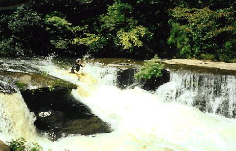
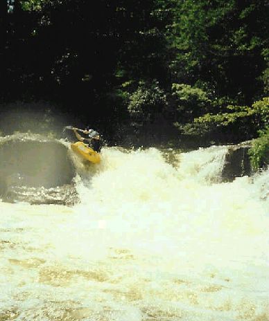
Mary D' negotiates the slide just above Factory Falls. Lots going on here. We got the Bubba belly on the cooler in the background. Try not to run over th (...)
Boyd on the surfing wave at the top of this slide (photo courtesy Boyd Ruppelt)
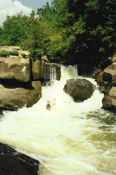
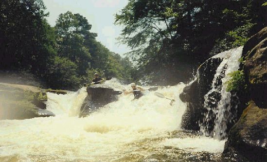
Boyd just below the undercut decapitation rock at Factory Falls, shortly after seal launching downstream of the main drop. (photo courtesy Boyd Ruppelt)
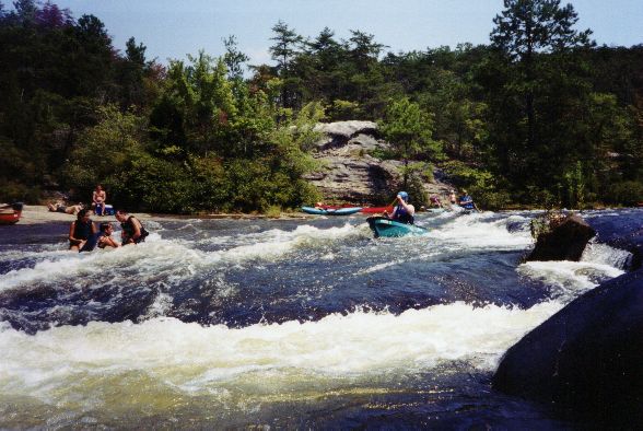
The lower part of the class III rapid below Factory Falls