Mill Pond / Cotaco Creek Mill Pond Bridge to Ruth Rd
-
RunMill Pond / Cotaco Creek
-
ClassIII-IV
-
Put InMatt Morrow Rd.
-
Take OutRuth Rd
-
Length (mi)3.8
-
Gradient (fpm)70, 110, 60, 0 (0.8)
-
Watershed (mi2)11.3
-
Primary Gage
- Put-In Bridge -4" min, 6" high, 1.5' (yikes)
-
Indicator Gage
- Blue Springs 60
Description
This is a fun tight run that never gets over class IV at reasonable levels. Probably first run by Ricky Pollard and Terry Yancey. The gage is on river right at the put-in bridge. Minimum is about 4" below 0 (the step), though we have banged down it at -6". I walked out at 1.5', and 6" is about as high as most will want, since the majority of the rocks are covered at this level. 0" - 3" is probably about right. What is more serious at higher water are the trees. There are a few to portage on the steep section, then you have to negotiate a forest of smaller trees towards the 3rd mile. This gets very dicey if you happen to catch the run when there are leaves on the trees, since your downstream view is often blocked. We cut out most of the trees in the steeper section late in 2000. However, after the mega 10"+ rain of August 2001, ther are a lot of whole trees that are now leaning over from the bank. On the bright side, the flood did wash out a jam in the tree section towards the end.
The run starts out as amusing II-III. Then it gets more serious just upstream of where Hog comes in from river right, but nothing is over IV and there are no major undercut issues. You know the action is beginning when you get to Debate, a 6' slide type rapid that can be run on either side. The debates occur at higher water because this is the last good place to walk out (go to river left and walk a bit upstream). This is followed by Hogs Tooth, a 5' drop which is much better in the center slot. Deep V is the biggest drop, just downstream of a right turn, and may be a scout. It is narrow and at good water is a happening thing. This rapid may push you right at the bottom into an undercut that is not a big problem, but has potential. We think that a new rock has been moved by the flood to the top right side of Deep V. At low water the rock makes things decidedly more difficult, and it may well do the same at decent to good levels. There is a tight drop with a log in Coondog Corner where the river is split by an island. More water here helps a lot.
Just after a small waterfall named Sinking Falls, immediately downstream of a river right cliff (watch for a big hole at 6") at about mile 1.8 or so, some of the water goes into a sink on the right. At summer levels, all the water goes in this sink. The lower part gradually falls off to flatwater at the end. Before it does it goes through a bushy section that is not too bad at low water and resembles a natural slalom course through the wood.
Blue Springs is a pretty good indicator gage. In the wet season, recent rain of 1"+ may bring it up. It has a small short watershed, so it runs off very (12 hrs +/-?) fast.
Other random notes:
The put-in road is shown as Ruth - Hog Jaw Rd on the Delorme map but really is Matt Morrow Rd. Power lines at ~mile 1.8, old bridge at mile 2.15. Cotaco is an easy walk for most of the run, possibly because it was once used by Native Americans as a pathway from the Tennessee Valley up onto Bridlee Mountain. Coon dog trials are held behind a house near the put-in for your entertainment.
Possible upper put-ins exist on Gilliam Creek if Pine Lake is spilling or on Perkins Creek. Hog Creek comes in from the north (not Hog Jaw). It looks beafy, super narrow, and blocked just above its confluence. About 0.9 miles from the 1st bridge to Cotaco, drops about 120' total, 90' of it in last 0.25 mile. Sewage treatment plant on Gilliam? This creek has nasty water in it!
Details
-
ClassIII-IV
-
Gradient (fpm)70, 110, 60, 0 (0.8)
-
Length (mi)3.8
-
Watershed Size (mi2)11.3
-
Put InMatt Morrow Rd.
-
Take OutRuth Rd
-
ShuttleMatt Morrow / CR 418 / Ruth
-
Water Quality
 (
3 chickens | 1 = Good, 3 = Gross)
(
3 chickens | 1 = Good, 3 = Gross)
-
Primary Gage
- Put-In Bridge -4" min, 6" high, 1.5' (yikes)
-
Indicator Gage
- Blue Springs 60
-
Precip. Gage
Map
Video

Photos
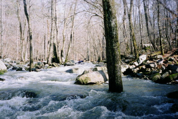
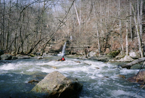
The upper part with copious water. Below here, is a rapid called Corner Pocket with an undercut on the left that comes into play at high water.
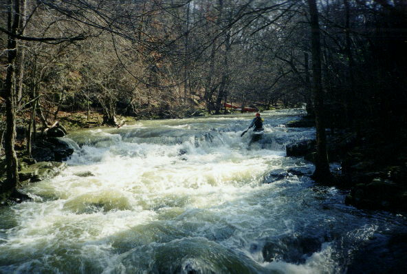
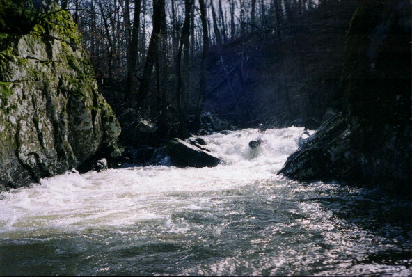
A marginal lighting situation but a good view of the upper part of the first significant rapid, Debate. Once you hit the first horizon line, things get going.
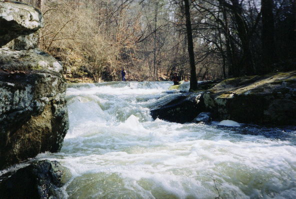
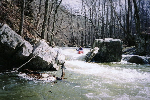
Debate from a different angle
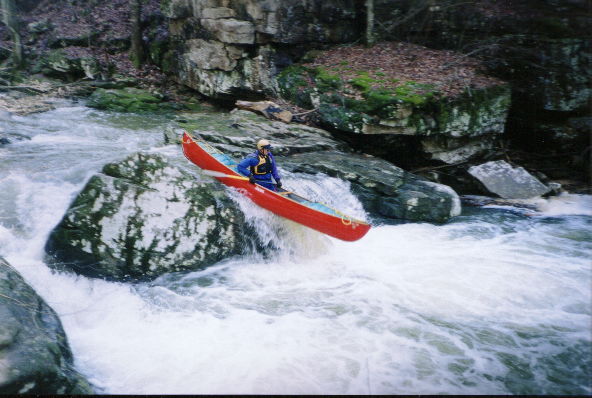
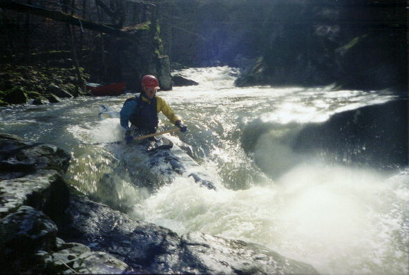
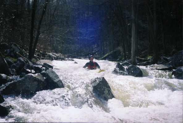
Dave clears the center slot in Hogs Tooth
Richard Brown amongst the rocks and trees of Coondog Corner. The creek splits here and more water would have been nice. All three canoeists had to (...)
Richard gets propelled right at the most significant drop, Deep V. That rock on river right is a bit undercut.
The next rapid down from Deep V, with water splotch on the lens.
Gary 'Log Probe' Holder leads the way through Luau. You had to do the limbo some. What is Dave up to in the foreground?
Pretty. Not far above Sinking Falls.
Dave busts towards a wide slot just Sinking Falls. The sink is on river left below the falls.
Gary and his Phat (only slightly visible)
Trip Reports
Mill Pond / Cotaco Creek
February 17, 2001
Written by Mark D'Agostino
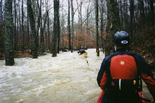
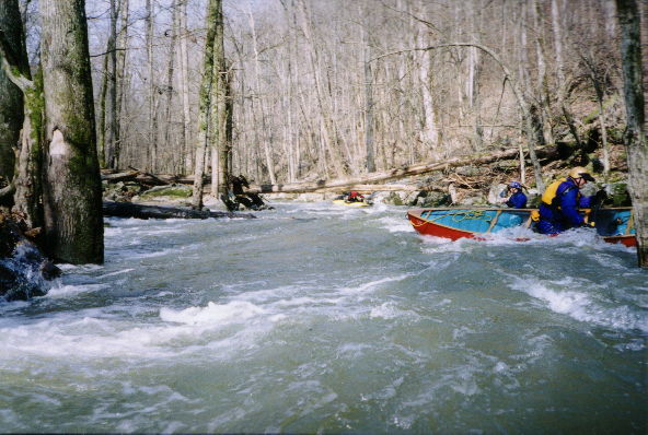
We finally ran it! Gary H, Dave B, Richard B, and I went the day after an evening rain. We deemed -4" to be enough water, which it turned out to be. Dave C and I first walked this late last year, then the two Daves and I chopped out the first 1.5 miles or so, and we met the landowner. I found out Ricky Pollard and Terry Yancey had run it at low water a few years ago and painted a gage at what they thought 0 should be. Gary, Dave and I found out that 1.5' was definitely too high the day we ended up running Perkins after we walked out of Mill Pond at the top of the steep part. That day, we waited twice on shore for the water to come down but it was not going down fast enough. We ferried across to river left, then carried up the bank and took out in someones back yard. When we got to the bottom, the take-out bridge was well under water.