Little River Canyon Suicide
-
RunLittle River Canyon
-
ClassIV-V
-
Put InRt. 35 1st Rt. 176 lot
-
Take OutChairlift, Powell Trail, or Canyon Mouth Park
-
Length (mi)2.5
-
Gradient (fpm)120, 80, 20
-
Watershed (mi2)141
-
Primary Gage
- Little River near Blue Pond 250 cfs (~500 cfs better)
-
Indicator Gage
none
Description
This is the best known difficult run in Alabama. III and IV abounds. Put-in is either the first pull-off on Rt. 176 or just above the falls. The falls are run by the skilled and psyched above 1,100 cfs on river left. At about 1000 cfs the Suicide section is pushy and above 1,800 cfs it is very serious. Levels higher than that are beyond my means to comment on. You'll find me at Johnnies, Little Bear, or Wolf (not the Wolf in the canyon) if it is that high.
After a couple squirrely rapids, a river wide and very easy 8' drop can be run almost anywhere. Mammoth Rock is recognized by just that on river left at the bottom of a boulder garden left, or an easier 'sneak' right. Terminal Eddy is best run out of the back of the eddy on river right. Watch out for the undercut on the left, which often harbors wood and gets more dangerous the lower the level. Of course, calling attention to undercuts is somewhat redundant, because they are everywhere on this run.
Eventually you arrive at the big three: Avalanche, Cable, and Pinball. Avalanche is primarily a pinning hazard run left through the eddy and then back into the main flow. Below 500 cfs it is boat and body abuse, but it goes. The walk and scout are easy on the left. Below 400 cfs or so the center line opens up. Piecevor is a neat right to left boof with a tricky hole just above. Cable is a straightforward V - a 12' waterfall followed by a boof to the right at levels above 700 cfs. The first drop is a bit of a pain as the water gets lower since you must run left. The second drop is not trivial, normally run close to the right edge off a boof (not too close) of the main drop. It too gets much harder below 500 cfs because you must slide off it on your left side into a hallway formed by the rock downstream. If you swim left, you may go under an undercut, but swimming here is not a good plan at all. Pinball is bona-fide class V. Not a place to make mistakes. Scout or walk right if you have not seen it's non-trivial moves and scary undercuts before. Be aware of the hazard in the runout on far river left, it has taken one of the best of us. The walk is easy. Once you get past Pinball, it is surprisingly flat for quite a while.
Logs often collect at the entrance to Pinball, and one is there in spring 2009.
Mileage is to the top of the Upper 2 section. Linked map only shows down to Chairlift put-in. The first shuttle takes out at the Chairlift (not recommended, but I've done it too many times). Essentially everyone always runs the Suicide together with the Upper 2. Many people take out at the chairlift, while others continue on to the Canyon Mouth park at the bottom of the Chairlift section. Another take-out option exists at the Powell Trail a short distance below Bottleneck on the Chairlift section.
Suicide can be run pretty darn low. 250 cfs is a resonable minimum. My ideal level is 500 to 1,200 cfs. Cable is not so hard and the rest is not out of control. Many people run it and love it low, I'm not one of them. Things get pushy above 1,600 cfs.
Details
-
ClassIV-V
-
Gradient (fpm)120, 80, 20
-
Length (mi)2.5
-
Watershed Size (mi2)141
-
Put InRt. 35 1st Rt. 176 lot
-
Take OutChairlift, Powell Trail, or Canyon Mouth Park
-
ShuttleRt. 176 or Rt 35 / Rt. 273 / CR 275
-
Water Quality
 (
1 chicken | 1 = Good, 3 = Gross)
(
1 chicken | 1 = Good, 3 = Gross)
-
Primary Gage
- Little River near Blue Pond 250 cfs (~500 cfs better)
-
Indicator Gage
-
Precip. Gage
Map
Video
Photos
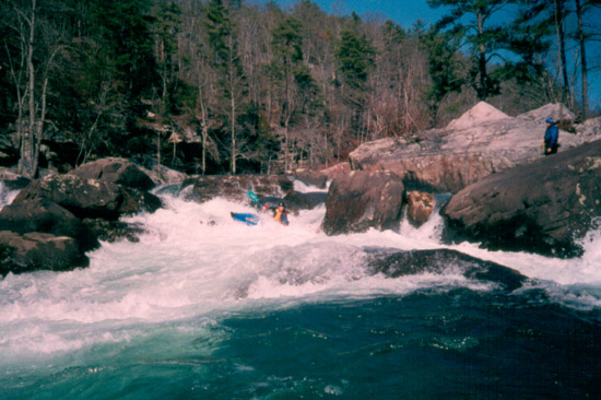
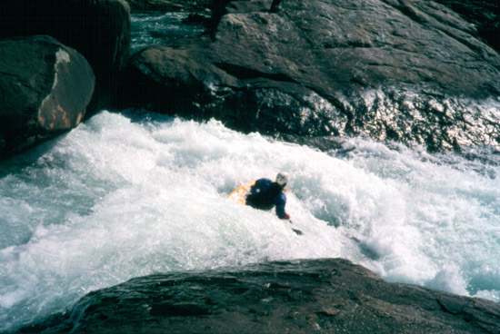
Katie ? executes a smooth line on the lower part of Avalanche. All these pictures are at 5" on the Rt. 35 bridge gage.
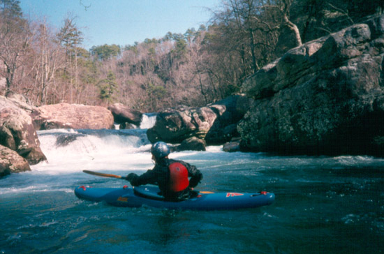
The view back upstream of Cable Falls. The first drop is a 10' to 12' waterfall. The second is run off the boof just above the yakkers bow. If you run ove (...)
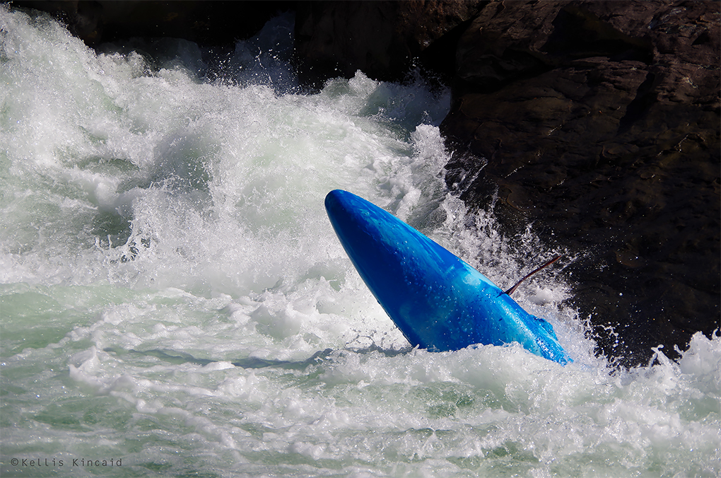
Pike Briggs pre-squirt on Pinball. (Kellis Kincaid, January 2020)
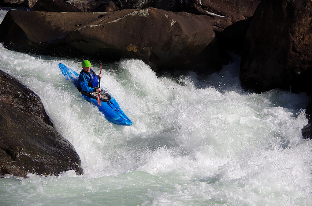
Pike earning those style points on Pinball. (Kellis Kincaid, January 2020)
Marshall Fox looking down the barrel of the last drop on Pinball. The rock on river left just upstream of him is rather undercut.