Terrapin Creek Multiple (see below)
-
RunTerrapin Creek
-
ClassI
-
Put InCR 8 (Frank Stewart Br.)
-
Take OutSR 9 (near Old Coloma)
-
Length (mi)7.3
-
Gradient (fpm)8.2'/mile
-
Watershed (mi2)171
-
Primary Gage
- Terrapin at Ellisville 300 (see text)
-
Indicator Gage
none
Description
Terrapin Creek is not really a whitewater run, but it is a nice moving water float through pasture land in east Alabama. At 650 cfs, the water moves nicely for at least half of the run. The area a few riffles and one class I/II rapid towards the end. This is a very nice family float or introductory run for those looking for moving water practice or a place to work on their roll. Terrapin will hold water longer than most runs due to watershed lakes in its headwaters. Terrapin Outdoor Center features a large selection of canoes, kayaks, and gear. They will also run your shuttle for you for a fee.
Several Notes and perspectives:
The swimming place where the springs come out of the ground and flow into the creek ("Seven Springs") is private property. The previous owners used to not have a problem with people hanging out down there and just having a good time. Unfortunately, the new owners aren't so understanding. The last time I was down there, I was confronted by a man carrying a shotgun. Not a lot of fun! I think anyone would be OK as long as they don't pull their boats up on the area where the springs are. I'm not sure how far the property line goes, but it might be possible to leave the boats right before where the springs come in. - Jeremy Jones
Put in point: Frank Stewart Bridge, on CR 8 about 3.5 mi. north of Piedmont (USGS Piedmont Quad, Township 12S, Range 10E, section 20). This run is about 7.5 miles of mostly easy wide creek with a few rapids probably class I or less. The rapids are clearly shown on the USGS topo map. Minimum flow should be about 600 CFS but 800-1000 is probably optimum. At lower levels there are a lot of shallow rocks that will tear up a fiberglass canoe, as I discovered recently. The take out point is at a pullout along SR 9 where the creek flows near the road. The pullout is very obvious because a lot of vehicles use it (It is rather trashy there). The take out point is at USGS Ellisville Quad, Township 11-S, Range 10-E, Section 31. If you want to continue from here there is much less whitewater but the secondary takeout point is at Ellisville bridge about 2.5 miles north on SR 9 and about 4 more miles by creek. This bridge is where the USGS gage is. The water quality is probably so-so at best, the worst part being that there is a lot of debris washed up on the shoreline along the run. There are some good fishing and swimming holes along the way, a very popular swimming hole at about mile 6.5 just past a big spring on the left you mill see a tree on the right with a cable swing. - Stephen Brewer
I was just going to make a few comments on Terrapin Creek. I have been fishing there with a gauge reading of 175 cfs, and only scraped in a few spots. At this level the water was quite clear.The fishing is very good for bass and panfish.You will see many gar over 4',in length. There are a couple of spots that might offer surfing at high water, but I don't know. At moderate levels this is no place to be in a whitewater boat, unless you want some serious cardio exercise. The flatwater stretches are quite long. This run passes through mostly wooded hills, and skirts a few pastures, but houses won't be seen until the end. All in all this a good place to take the family on a float trip, just don't expect much excitement. The people at Terrapin Outdoor Center are friendly and helpful. They also have good deals on canoes and rec kayaks. -Josh Tidwell
There is another section with whitewater above the 'usual' run. It is from the 3rd bridge to 1st bridge in Vigo. Our run was made when the water was flowing at about 800 cfs. There are about 4 or 5, 2 to 3 foot drops in this section with a few surfing holes. So if you catch the water right, you can have some fun here. The only problem is at the takeout at the 1st bridge, we had to pull our boats up the bridge with a rope. It is very slick on the side of the bridge. This is a very short run, about 45 minutes to an hour, BUT FUN. When the water is up, the 'usual' section is also pretty fun. The are only a few holes in this section with only one good surfing wave, seven springs. Unfortunately, it is near the end of this section and you are pretty tired, not a lot of playing. -Jeff Riffey
(Looks like there were at least three old mills along this stretch in yesteryear, and I've also heard this is good fishing - MD')
Details
-
ClassI
-
Gradient (fpm)8.2'/mile
-
Length (mi)7.3
-
Watershed Size (mi2)171
-
Put InCR 8 (Frank Stewart Br.)
-
Take OutSR 9 (near Old Coloma)
-
ShuttleCR 8 / SR 9
-
Water Quality
 (
2 chickens | 1 = Good, 3 = Gross)
(
2 chickens | 1 = Good, 3 = Gross)
-
Primary Gage
- Terrapin at Ellisville 300 (see text)
-
Indicator Gage
-
Precip. Gage
Map
Video
Photos
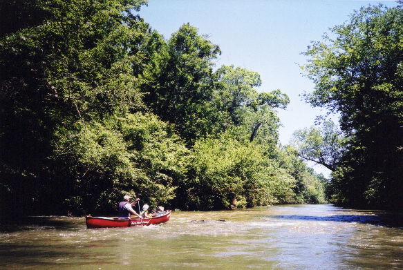
John and Abby Conover on Terrapin Creek at about 650 cfs
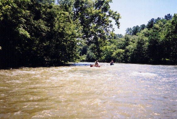
John, Abby, and Mary D'
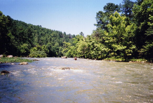
The longest and best rapid on Terrapin
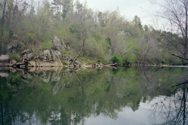
Terrapin Creek quiet water (Photo Courtesy Mark Cumnock)
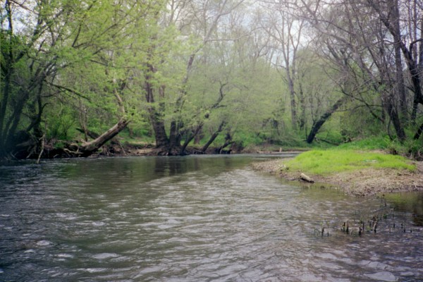
Terrapin Creek (Photo Courtesy Mark Cumnock