Locust Fork of the Warrior Nelson Gap
-
RunLocust Fork of the Warrior
-
ClassI-II
-
Put InLittle Cove Rd
-
Take OutPearman Rd
-
Length (mi)4.2 miles
-
Gradient (fpm)~30' total
-
Watershed (mi2)72.6
-
Primary Gage
- Locust at Cleveland 231/79 bridge 2.5', higher is better, 5'+ getting high
-
Indicator Gage
none
Description
Please be respectful of the landowner at the Gap (especially during deer season). Keep in mind that this is private property and while we may have a legal right to paddle the river, we still must be good neighbors and if we have to portage, we are trespassing. Also, please don't attempt this stretch at high water if you are not fully confident in your ability to avoid trees/strainers in moving water. Like a lot of our whitewater runs, there are trees to avoid in various places.
Alabama has some interesting geography. I shouldn't have to tell you that. One of its oddest features forms this run. Anyone who has looked at a topo map around here eventually has noticed Nelson's Gap at the Intersection of Marshall, Blount, and Etowah Counties. I remember the first time I looked at on the old Delorme USA software, it looked like the Locust flowed uphill. What's actually going on is almost that bizarre - the Locust is cutting through to get onto Sand Mountain. That's correct, this is the only place I know of in Alabama (in the US?) where a river flows onto, not just off of, a mountain. Well, the water knows what it is doing even if we try to impose our man-made names on it.
From Jason Jackson, who has actually made the run:
The level in the pictures was a blasting 2.1 on the Locust gage. This would be an absolute min. level for sure. I don't think I had to get out of my boat for low water, but there was some wheel chair action in several places. I would most likely set the min around 2.5 or 2.8 although the higher the better on this run (I do have a high tolerance for boat/rock interfaces). There were many trees, but no real large log jams. I think this section could be a great run if the access was better.
This section is a must for Alabama geography buffs and a good option for a beginner that might not want to get on section 3 or 4 of the Locust. It is a serene detachment from the busy, crowded world around. The scenery is very nice with no real sign of development for most of the run. No homes are visible until the last 1/2 mile of the run. Once in the “Gap” the bluffs shoot up hundreds of feet on each side of the river and several nice rock formations in the river bed make for some very interesting sights. The fishing is good and the water quality is not bad.
The only real put in option is the bridge is on Little Cove Rd. It has a fair place to park at the corner of Bristow Mill Rd and Little Cove Rd. and a good place to launch into the water on river left. Bluff Drive as a take out option would involve a 1/3 to 1/2 mile walk that is somewhat thought of as private land even though it is still a county road (really a stretch to call this 4 wheeler trail a road). The owner is a nice guy, and doesn't live on the land. If a person wanted to take out here I don't think you would have any real problems. When you see the old bridge pillars you will see the confluence of Clear Creek on river right just down stream. This will mark the Bluff Drive take out. The other option is about 2 miles of flatwater to Pearman Rd and a very user friendly take out at the "Old Snead" mill pond.
Phil Foti offers:
... the interesting thing was indeed geology....just up from the put-in looking across a pasture, the Locust has the character of a river approaching it's terminus... it forms a series of ox bows and becomes braided, from all appearances it has the common river morphology of a river that has dropped off into a coastal plain or delta region... and then as the flow/gradient picks up at Nelson's Gap, the appearance becomes more familiar to what we are accustomed to seeing.
Jim Schwaiger:
We paddled Nelson gap in October 2009. The put in is actually at the bridge on Murphee Valley Rd. near the intersection of Little Cove Rd. Parking is at that intersection. There was no parking on the west side of the takeout bridge. There is room for 3 or 4 cars on the NE side and the landowner on the SE side let us park on his land, although he understandably doesn't want anyone to block his driveway. The low head dam just below the bridge has a large (>10 foot) drop that is dangerous at the levels we saw. Paddlers should have a look from the takeout bridge facing north (downstream) to make sure there is an easy landing. The safest and most convenient takeout was below the bridge at river left. There is an easy carry up an old dirt road to the west side of the bridge. Carry back across the bridge to your car.
The run itself was about 2 miles of moving water, then 2 miles of easy (and nicely spaced) Class I/II rapids, and finally 3 miles of moving water. There was one big strainer before the rapids that we had to portage and one strainer we had to cross well after the rapids. The 2 miles of rapids were clear and very enjoyable with the Locust gage at 3.7 feet.
Details
-
ClassI-II
-
Gradient (fpm)~30' total
-
Length (mi)4.2 miles
-
Watershed Size (mi2)72.6
-
Put InLittle Cove Rd
-
Take OutPearman Rd
-
ShuttleMurphree / Hwy 278 / Pearman
-
Water Quality
 (
2 chickens | 1 = Good, 3 = Gross)
(
2 chickens | 1 = Good, 3 = Gross)
-
Primary Gage
- Locust at Cleveland 231/79 bridge 2.5', higher is better, 5'+ getting high
-
Indicator Gage
-
Precip. Gage
Map
Video
Photos
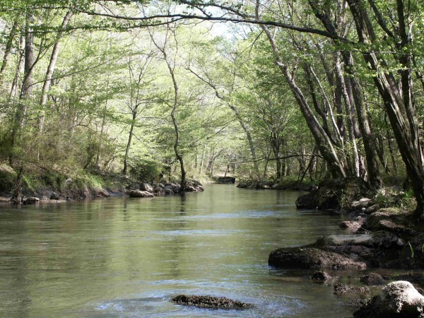
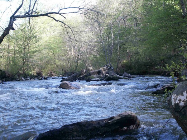
Scenery, not whitewater, but nice (photo courtesy Jason Jackson)
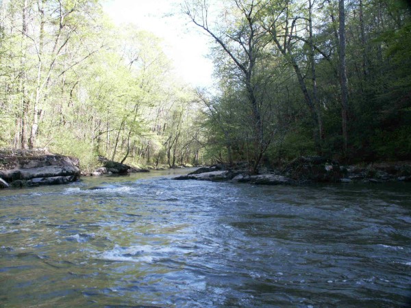
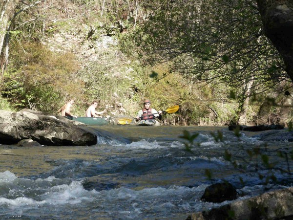
(photo courtesy Jason Jackson)
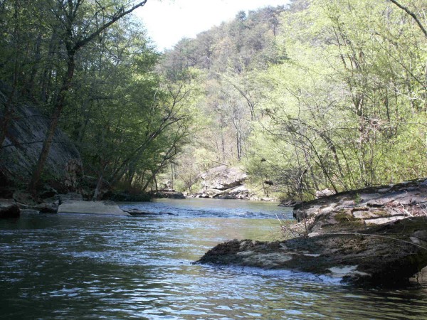
(photo courtesy Jason Jackson)
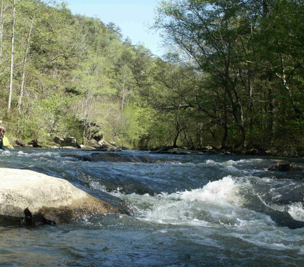
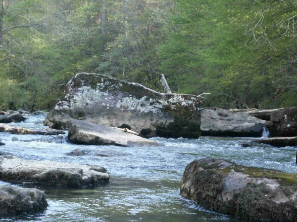
Gradient! (photo courtesy Jason Jackson)
(photo courtesy Jason Jackson)
(photo courtesy Jason Jackson)
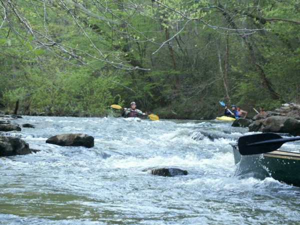
These rocks may induce some action at high water (photo courtesy Jason Jackson)
(photo courtesy Jason Jackson)