Turkey Creek (near Pinson)
-
RunTurkey Creek (near Pinson)
-
ClassI-II (III)
-
Put InNarrows Road (CR131)
-
Take OutTreatment Plant Road {or Bradford Rd (CR 121) or 7.7 miles to
-
Length (mi)1.3 or 7.3
-
Gradient (fpm)40, 35, 25, 20, 15, 15, 15 (1.3)
-
Watershed (mi2)26.3
-
Primary Gage
- Turkey Creek 200 (or less)
-
Indicator Gage
none
Description
Turkey Creek is of interest to the paddler for a couple of reasons. Located only 30 minutes from Birmingham, Turkey Creek flows through the newly established Turkey Creek Nature Preserve, set aside by Jefferson County presumably to protect the remaining habitat of the endangered Vermillion Darter. Although there is a road through the preserve, the scenery is nice and the wildlife (including raucous locals) is abundant at times. The section described here is from Narrows road to just upstream of the Wastewater Treatment Plant, a distance of about 1.3 miles. Just off Hwy 79, this would make a nice addition for paddlers headed back from the Locust Fork.
Turkey Creek pretty much eats up its 15 feet of gradient in 1 drop, which all the locals call "the falls". It's a fairly straightforward sliding drop around a sharp right hand bend in the creek. At higher flows, the falls are followed by a long, screaming wave train through a narrow streambed set between steep banks. Once the creek cuts back towards the treatment plant, it might be time to find a place to bushwack out to the road. The water quality of Turkey Creek is superb through the preserve, unless there has been recent heavy rain. Turkey can be run all the way to its confluence with the Locust Fork some 20 miles downstream of the preserve, but the rapids are generally small and the limestone outcroppings are often overshadowed by abandoned strip mines and dense stands of Privet and Mimosa. The gradient is described above for up to 7.3 miles, but only the 1.3 miles of the falls stretch are "recommended". - Shane Hulsey
A put in at hwy 79 allows large but muddy parking, some extra shoals, & one 2' lowhead dam. Be careful of the metal sluice at the treatment plant, run center (can you say tetanus?). Downstream of the plant it's pretty flat, then there's a pond near the land fill. At the end of the pond is the only real rapid after the plant.- JD
Details
-
ClassI-II (III)
-
Gradient (fpm)40, 35, 25, 20, 15, 15, 15 (1.3)
-
Length (mi)1.3 or 7.3
-
Watershed Size (mi2)26.3
-
Put InNarrows Road (CR131)
-
Take OutTreatment Plant Road {or Bradford Rd (CR 121) or 7.7 miles to
-
Shuttle
-
Water Quality
 (
3 chickens | 1 = Good, 3 = Gross)
(
3 chickens | 1 = Good, 3 = Gross)
-
Primary Gage
- Turkey Creek 200 (or less)
-
Indicator Gage
-
Precip. Gage
Map
Video
Photos
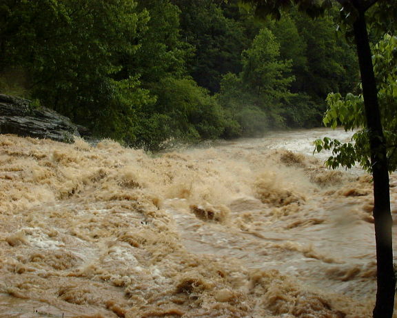
The falls on Turkey at flood. It rained 10" in 4 hours in Pinson this day. (photo courtesy Shane Hulsey)
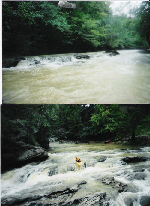
A shoal on Turkey Brian McAnally on the falls at slightly lower water than the first picture on this page (photos courtesy John Duncan)
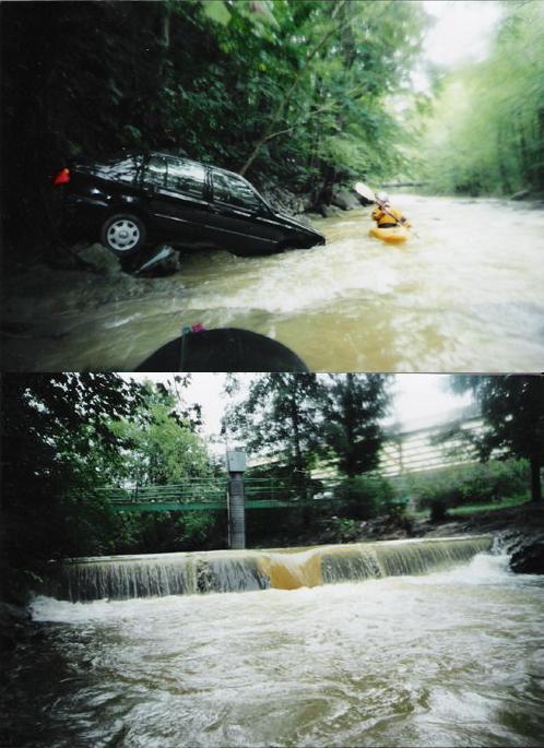
Brian next to some pretty nice river booty. Don't know how he got in in his boat. The gage and sluice by the water treatment plant (photos courtesy (...)