Weoka Creek
-
RunWeoka Creek
-
ClassI/II (III/IV)
-
Put InCR 432 (Sewell Rd)
-
Take OutCR 29 (Titus Rd)
-
Length (mi)1.9
-
Gradient (fpm)20 (roughly)
-
Watershed (mi2)74.9
-
Primary Gage
- None Visual
-
Indicator Gage
Description
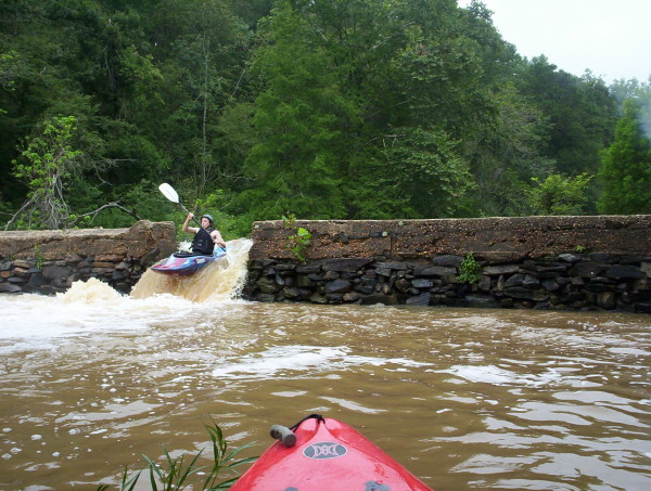
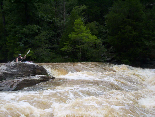
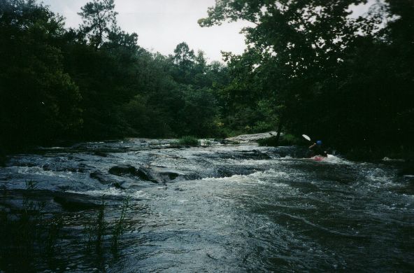
Weoka creek is a short run into the east side of Lake Jordan north of Montgomery. It is mostly I-II with one rapid which resembles a "smaller" version of Jawbone on Chattooga Section IV, though I'm not so sure about the Jawbone comparison. Weoka is a smaller, steeper version of the Coosa near Wetumpka. It has a sand and rock bottom (granite covered by that black stuff). The granite seams cross the streambed perpendicular to the flow to form ledge type rapids. There is minimal action and several pools until you reach the old Weoka Mills. Here the creek drops about 15' through a series of 2-4' ledges and an old dam. This would surely rock at higher water levels (we ran it ridiculously low).
There are rapids marked on the topo map upstream of the CR 432 put-in, but not much gradient. Check it out if you wish. It looks like CR 429 (Buyck Rd) would be the next bridge upstream. Putting in there would add about 4 miles to the run.
Hatchet is a possible rough level indicator. Recent rain is a key. Your guess is as good as mine as far as what a good level looks like at the put-in. Some flow would be a good start.
-help from Bill Patterson
Details
-
ClassI/II (III/IV)
-
Gradient (fpm)20 (roughly)
-
Length (mi)1.9
-
Watershed Size (mi2)74.9
-
Put InCR 432 (Sewell Rd)
-
Take OutCR 29 (Titus Rd)
-
ShuttleCR 432 / CR 29
-
Water Quality
 (
3 chickens | 1 = Good, 3 = Gross)
(
3 chickens | 1 = Good, 3 = Gross)
-
Primary Gage
- None Visual
-
Indicator Gage
-
Precip. Gage
Map
Video
Photos
The dam, one of two overflow channels. Photo courtesy Pat Steele
Tommy Steele in the meat of Weoka. Photo courtesy Pat Steele
Another Shot, same place Photo courtesy Pat Steele
Jason Ory. Outrageously low water.
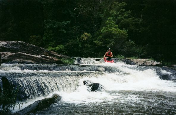
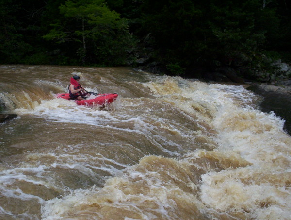
Gary Holder on one of the top drops of the last, and only, significant rapid. This would be big at high water.
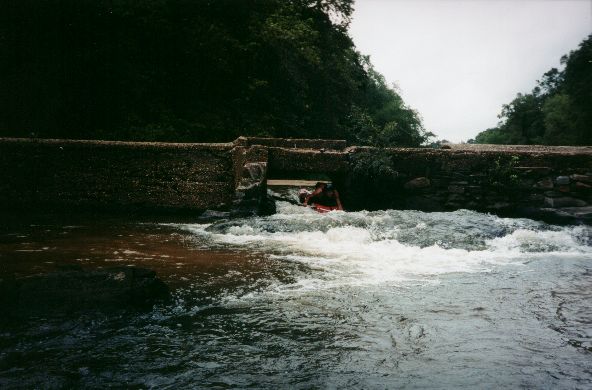
It was so low we ran through the dam...
Trip Reports
Labor Day Whitewater: Two W's
September 2, ????
Written by Mark D'Agostino
Mark D'Agostino (C-1), Gary Holder (C-1), Jason Ory (K-1)
Gary and I had talked about going Saturday, but the rain was just getting its act together. The best water was to the south on Sunday, so we decided to go. Jason joined us in Cullman on the way down.
We knew that Hatchet was on its way up, so we were fairly confident there was some water south of Birmingham, which we knew had lots of water but not many runs. Our first objective was Walnut Creek, which flows out of Clanton into Lake Mitchell not far from Highway 65. I had seen it on the topo and knew it had decent 30-40 feet/mile gradient over 4.1 miles. I had been told it had some drops but knew no one who had run it. We got near Walnut without any problem but made a few wrong turns on some unmarked dirt county roads. Finally we found the put-in and proceeded to the take-out area. We had to take-out at the lake so we eventually just decided to park near some empty lake houses and sprint to the truck when we took out. Back at the put-in we ran into a local who canoes the first half of the run and owns a house right next to our take-out vehicle. His description of the run sounded promising.
We found the level to be minimal but OK. The creek remains narrow and is bounded by almost all granite, which is quite a change from north Alabama creeks. I think this was the only run I've done in Alabama that had granite boulder gardens. The water moved along nicely and was class I and II except for three rapids. The local guy called the first two III's 'the falls' and 'mill falls'. After the mill falls we thought we might have hit the lake but instead went under a couple river wide logs and a low water bridge. Just after that was the best rapid of the run, a three part ledge. We really liked Walnut and with a bit more water it would be worth another run. Club members with a bent towards the II (III) way of paddling will really like this run. It would be a fun run for someone who has not run creeks much or simply does not want a dose of fear with their paddling.
At the take-out we loaded up our gear and ourselves into and onto Jason's Jeep. We decided since we'd driven this far we'd have to make two runs. So we headed to Weoka Creek on the other side of the Coosa River. We put on and quickly discovered the flow was REALLY low. Gary had declared, "We can always drag our boats for 1.9 miles". Well, we did not have to get out of our boats but we did some dragging. There was little in the way of whitewater until we got to the old Weoka Mills. Here the creeks drops about 15' before it goes over or under the old dam. This rapid would edge up to class IV with possible big holes at high water. Unless you live in the area, Weoka is only probably worth running in combination with something else in the area.
Jason has just started to paddle whitewater this summer but he did very well, having no problems except for the odd spin cycle by shallow rocks. It is fun to see somebody in the initial super high enthusiasm stage that that gets you on the water every week. This year has been good for that with all the rain. Reminds me a bit of 1994.