Collier Creek
-
RunCollier Creek
-
ClassII-III (IV) low water
-
Put InCR63
-
Take OutCR3159 (F.S. Road 255 {Hickory Grove Rd.}
-
Length (mi)4.2 to Brushy, then 4 on Brushy
-
Gradient (fpm)20, 80, 20, 20 (1.2)
-
Watershed (mi2)1.9
-
Primary Gage
- None Visual
-
Indicator Gage
- Sipsey Fork near Grayson Spiking - very recent or ongoing rain
Description
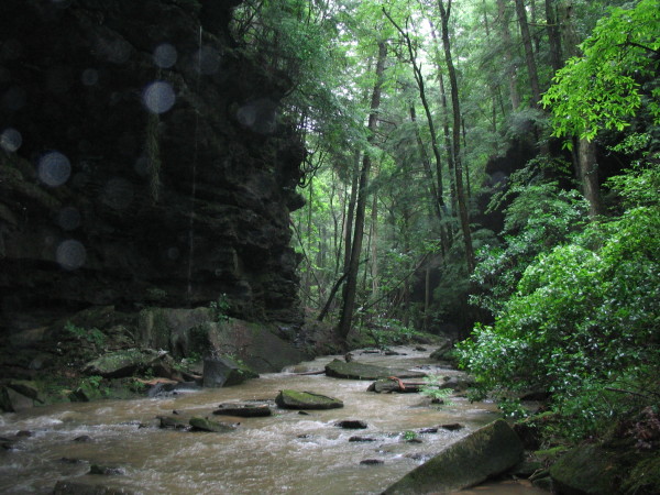
In my book, Collier Creek is the most scenic waterway in Alabama. It is beyond LRC, beyond the Walls of Jericho. If it had better whitewater, it would be a shrine. Think of it as a spectacular boat-assisted hike in the Sipsey area. Run it in the summer and the old trees and overhanging canyon walls with vines and waterfalls create a beautiful backdrop to a tiny creek. It is an experience, but not a purely whitewater experience. It looks like many of our runs probably looked before the days of municipal plumbing, mass agriculture, and trash. In Alabama, it is very hard to escape the chickens, loggers, or septic tanks completely, and it does have a few tires and old appliances, but not many.
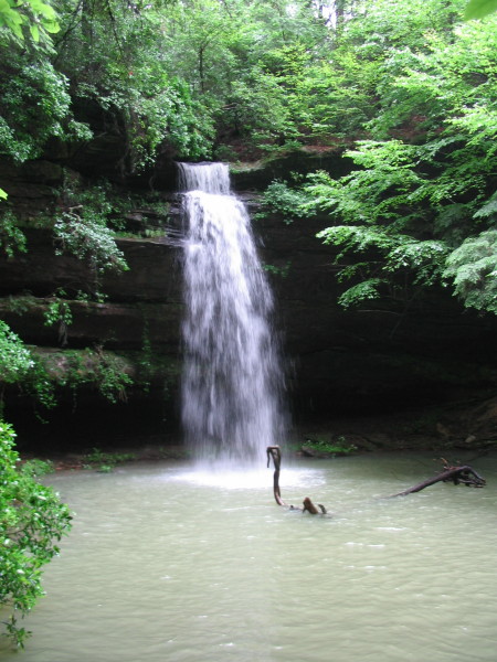
Collier has some rapids, maybe the best in the Sipsey area, but that is not saying much. The first mile has some little drops. About one mile in, the creek bends to the left then right and you'll hear Collier Falls. A 4' drop leads into a couple small ledges at the top of the 25' falls. The landing is shallow, only 3' deep or so. The bottom is rock and sand. A carefully pre-considered, not too flat boof would be required. We roped down the edge of the falls, but at high water, rappelling or a long walk may be required. The rest of the drops are class III or III+. The only one to note contains a rock which pinches the flow against the right cliff wall. Watch for logs here. Check out Shangri-La Falls on the left, you won't miss it. Gorgeous water color and very nice pool. After Shangri-La, the canyon begins to fade but the scenery continues to be top shelf. An old road crosses towards the bottom with a USGS style gage that either serves secretive paddlers or more likely 4-wheelers or Jeep drivers with clearance issues. We ran it at 1.35'. Brushy will be pumping when you get there.
The water quality is not the best, but there is a lot of logging in this area. Collier is a small tributary to Brushy Creek, and like many small/tiny creeks, you need very heavy rain in the last day or better yet, recent or ongoing heavy rain to get it going. We ran it after a few hours after Tropical Storm Arlene dropped an inch or so and it was very low, but we could tell by high water marks it had peaked at an OK level earlier. If you walk down about 100' downstream of the CR63 bridge, the first little riffles should only have a couple inches of exposed rocks for a decent level. Logs are present but not that bad considering how narrow the creek is. Limbo skills are a plus.
The shuttle is easy, CR63 splits off of SR33 just south of the CR6 turnoff to the normal Sipsey put-in. The put in is not far down CR63. The take-out is accessed on CR3159 to the east off CR63.
Collier is great hike. Go to the store in Wren at the SR 33 / 36 intersection and check out the detailed topo map on the wall. You can hike in from the north from the road that leads to Brushy Lake, then hike down the canyon and out at Shangri-La. A rope to drop in the canyon may be a good idea.
Details
-
ClassII-III (IV) low water
-
Gradient (fpm)20, 80, 20, 20 (1.2)
-
Length (mi)4.2 to Brushy, then 4 on Brushy
-
Watershed Size (mi2)1.9
-
Put InCR63
-
Take OutCR3159 (F.S. Road 255 {Hickory Grove Rd.}
-
ShuttleCR63 / CR3159
-
Water Quality
 (
2 chickens | 1 = Good, 3 = Gross)
(
2 chickens | 1 = Good, 3 = Gross)
-
Primary Gage
- None Visual
-
Indicator Gage
- Sipsey Fork near Grayson Spiking - very recent or ongoing rain
-
Precip. Gage
Map
Video

Photos
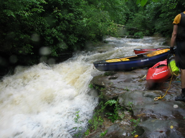
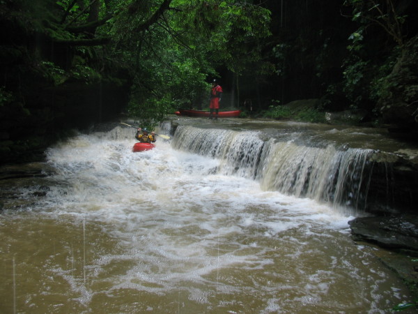
The lead-in drops to Collier Falls
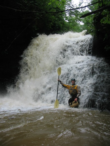
Brian demonstrates the shallowness of the water at the base. A bit higher level and/or a good boof and you are good to go. Portaging is not that easy.
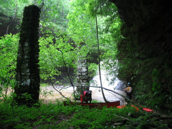
From an overhanging bluff at the falls. The two old support must have been for a mill.
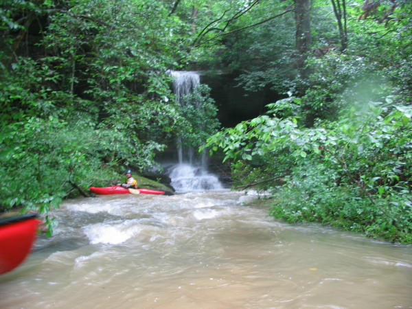
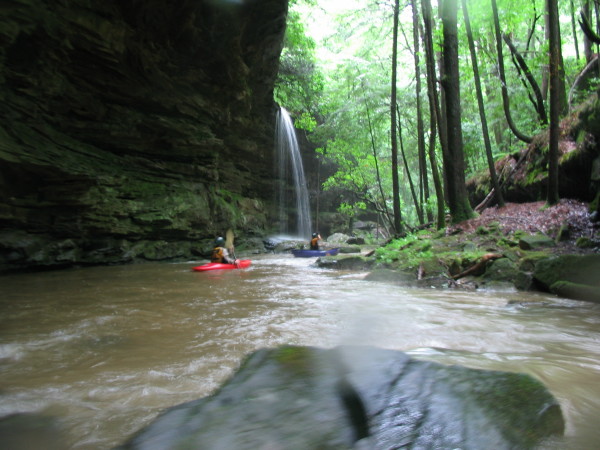
A nice waterfall at the outlet of the Collier Falls pool.
This drop has made its way into various scenery pamphlets and calendars.
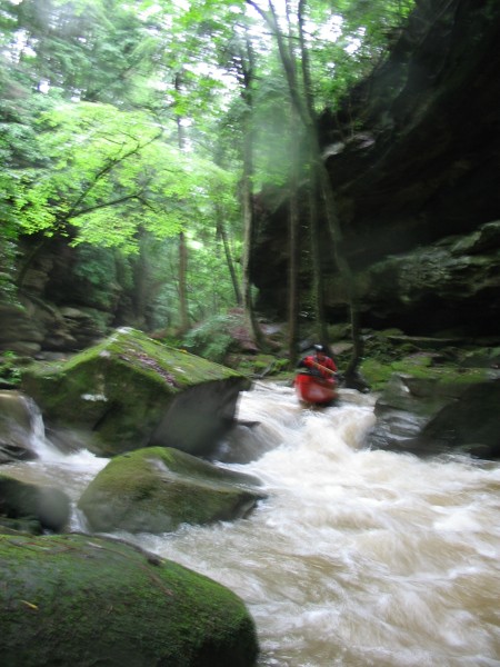
Just another typical gorgeous view along this micro-canyon.
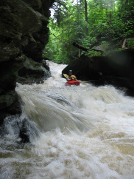
Brian at the bottom of the pinched rapid.
Blurry. Maybe this makes the level look less heinously low.
Shagri-La Falls. So nice.
A typical view. I should have used the flash more often.
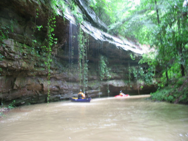
Fuzzy, but you get the idea. Another scenic bluff, this time with vines.