Mill Creek (Blount Springs)
-
RunMill Creek (Blount Springs)
-
ClassIII
-
Put InRt. 31
-
Take OutDirt Rd off CR 5
-
Length (mi)0.5
-
Gradient (fpm)80
-
Watershed (mi2)13.4
-
Primary Gage
- None Visual
-
Indicator Gage
Description
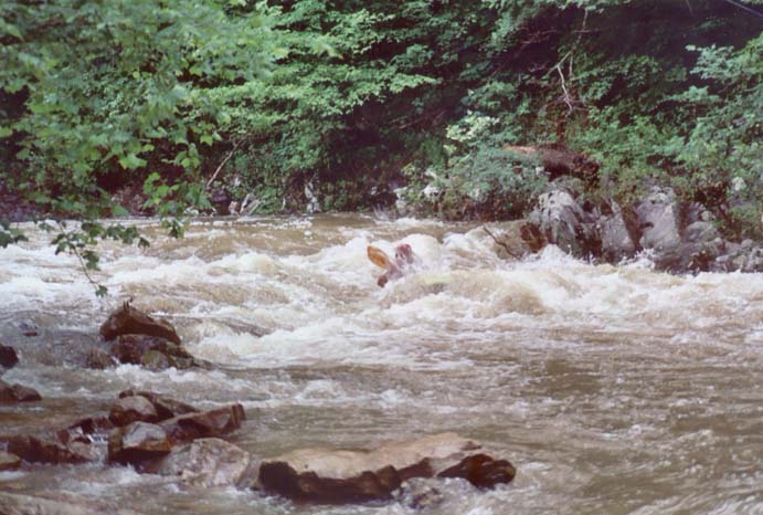
Brief but amusing if you happen to be at the Mulberry and there is many many water. Watch for logs, especially when you go under the road. The run is less than a mile long but has enough gradient to produce three fairly continuous strong class III rapids along with a few II's at moderate/high water. It is quite tight and can be a real conveyor belt on amphetamines. It needs lots of water to make it maximally speedy, though. Of particular interest is a rapid just above the bridge under Rt. 5 which sports a slight horizon line Further on is a longer rapid. But very soon the low water bridge takeout is upon you. Save yourself the trouble and go no further, there are a couple small surfing waves beyond but after that all you'll find is pasture. Minimum is probably around 5'-6' on the Mulberry 31 bridge gage, but any time water is abundant and you are in the area, check it out. Caution should be exercised before a run to ensure knowledge of any strainers in fast water sections; these could be dangerous.
A spring 2003 update: The downstream side of the river right put-in bridge bridge rock wall is a rock bench. A couple of inches over this really is minimum... six inches is fun but still a bone or two. We ran it at about 16 inches over the bench (Mulberry was running 18.72'/11') which made it continuous, pushy III+. A far right slot with a possible pin opens up in the second drop downstream of the tunnel (the Splitz). Use caution approaching the tunnel at this level. (thanks to JD)
Details
-
ClassIII
-
Gradient (fpm)80
-
Length (mi)0.5
-
Watershed Size (mi2)13.4
-
Put InRt. 31
-
Take OutDirt Rd off CR 5
-
ShuttleCR 5 / dirt rd.
-
Water Quality
 (
2 chickens | 1 = Good, 3 = Gross)
(
2 chickens | 1 = Good, 3 = Gross)
-
Primary Gage
- None Visual
-
Indicator Gage
-
Precip. Gage
Map
Video
Photos
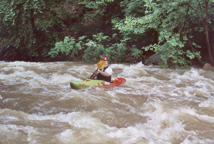
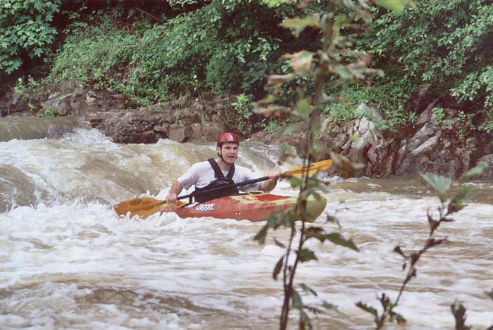
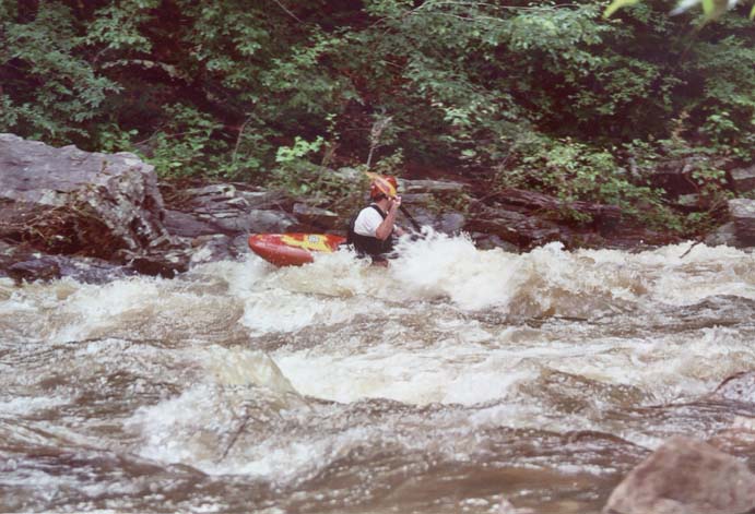
Some shots of Dustin Aker on Mill in May of 2003. (photo courtesy Dustin Aker)
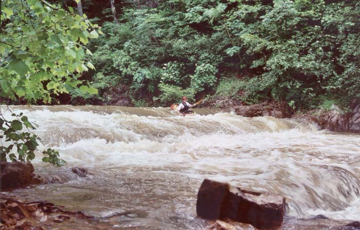
A double drop not far from the top (photo courtesy Dustin Aker)
(photo courtesy Dustin Aker)
Action towards the middle of the run (photo courtesy Dustin Aker)
(photo courtesy Dustin Aker)
Nice closeup (photo courtesy Dustin Aker)
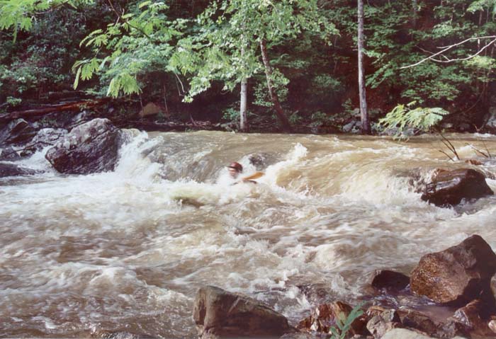
Near the bottom (photo courtesy Dustin Aker)
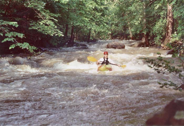
A typical shot looking upstream near the end of the run (photo courtesy Dustin Aker)
Trip Reports
Roadside Speed
January 27, 1996
Written by Mark D'Agostino
Level: Mulberry Gage Not Visible
Bored of the mundane, don't have a lot of time, Mulberry running a bit (way) too high? We've got a solution for you. Several miles south of the 31 Bridge, just past the Top Hat BBQ lies Mill (Mill on the topo., Murphy on roadsigns) Creek running next to Rt. 5 connecting Highways 31 and 65 (exit 289). Mill creek plummets over a dam in a subdivision east of 31 and then briefly encounters gradient before becoming just another slackwater slough off the Mulberry.
We had been lusting after this run for some time but had never found the right time due to the need for significant rainfall. We knew Hal had scouted it and some Birmingham folks had run it, but we may be some of the first Huntsville nuts to run it. It had looked runnable when the Mulberry was about 6', but this time we knew we had enough water because the gage was underwater. Chris Sherrod got together Mark D' (OC-1), his buddies Casey and Bob and John Parker (K-1) for the occasion.
The run is less than a mile long but has enough gradient to produce three fairly continuous strong class III rapids along with a few II's at moderate/high water. It is quite tight and at the level we had was a real conveyor belt on amphetamines. We had done enough roadside scouting to determine that strainers would be relatively absent and to get an idea of general stream character. As usual, the water level view made everything bigger. Of particular interest was a rapid which I hadn't noticed at all just above the bridge under Rt. 5. A reasonable horizon line was just downstream of where JP and I sat hugging opposite banks when Bob simply bopped though (not exactly his plan I believe). "Well, the right side looks survivable" I said, noting that Bob remained upright post-drop. Further on in the longest rapid, JP caught an eddy a little way in. The rest of us bid it a brief hello and good-bye through our peripheral vision. The water, she was mighty quick. Just about the time I felt warmed up we were at the low water bridge take-out. After some discussion we decided to continue downstream to another take-out on the Mulberry. We found two fantastic surfing waves and then a flat, windy, tree infested lake masquerading as Mulberry backwater. Here's a tip: don't go past the low water bridge.
This run was extreme fun because it was a) new, b) seldom available/run and c) a blast. We had a few locals stopping along the road for the usual "What in THE hell is going on down there." This run requires maximum water and a comfort level in fast water. Minimum is probably around 5'-6' on the Mulberry 31 bridge gage, and that would be easy tight class III. Most of all caution should be exercised before a run to ensure knowledge of any strainers in fast water sections; these would be dangerous.