Tallapoosa River Below Thurlow Dam
-
RunTallapoosa River
-
ClassII-III (IV)
-
Put InThurlow Dam
-
Take OutBoat ramp off Rt. 229
-
Length (mi)1.5
-
Gradient (fpm)
-
Watershed (mi2)3310
-
Primary Gage
- Release Info 1200 (see text)
-
Indicator Gage
none
Description
A comprehensive description from Bill Patterson:
This is a remarkable big water run in central Alabama. The water is powerful, clear and relatively cold. The only catch is that it is hard to catch. It usually runs in short intervals often right around dusk. To complicate matters, Alabama Power Company has a habit of changing the schedule at the last minute. It seems to run consistently at early nightfall in early spring (makes for some real interesting moonlight follies), after good spring/summer rains, and at fall lake drawdowns. There is a special black art to figuring out which lake levels and upstream dam releases are conducive to probable releases. For the locals who have figured out the release patterns, it proves to be a great after work run. For those who get it wrong and drive great distances it can let you down as you miss the water.
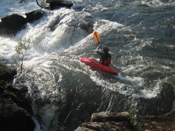
The run rates class II-III with a nice powerful class IV that rates V+ in areas. While the run is fairly easy, it is no place for beginners to blunder down. If you do not posses strong ferrying skills and good water reading ability stay away at higher levels. If you get stuck in one of the large holes above the falls and swim it would be very bad indeed. The water levels are as follows: min = 1,200 cfs, low = 5,000 cfs, good = 10,500 cfs, great = 11,500 - 13,000 cfs. You may be able to walk/scrape at min. At 5,000cfs you can get down pretty well but use extra caution at the falls. You will probably want to scout it from the island. At the 10,500 - 12,500 cfs levels Sticky Hole provides some great play and the falls are awesome. At 13,000 cfs Sticky Hole is usually good, you can find some huge surfing waves on the river right and the falls start to wash out. At 18,000 cfs Sticky Hole may be good, you will find some big one shot waves and the falls will be gone. At 50,000 cfs there is some action around what was formally Sticky Hole and the rest of the river is washed out.
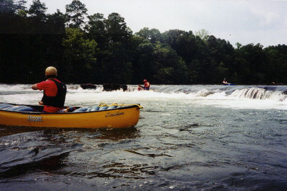
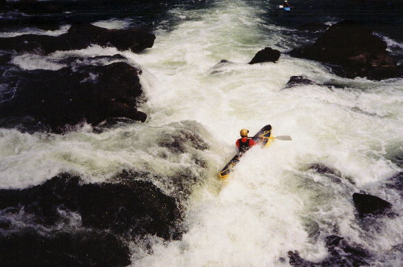
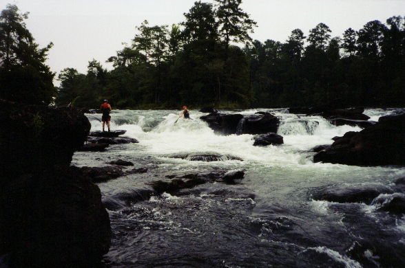
The run is just over a mile long and is quite wide (about 200'). After putting in below the dam outflow look upstream and imagine what may have been the Great Falls of the South must have looked like before the dam. Portions of the Class V+ at the base of the dam (as well as the dam) have been run. The authorities are still looking for the villain. About ¼ mile down stream the action starts. After running two class I shoals look for Sticky Hole on the left 1/3 of the river. You will find it next to the rock which makes a nice eddy. After Sticky Hole ferry over to the river right and catch some of the great breaking wave holes on the fly. Be wary of some huge holes at high water. At certain water levels you can surf several boats on the bigger waves. After the waves let up for about 200 yards look for Big O. It will be a nice breaking wave/hole toward the river right. It will have a nice recirculating eddy on the right. Catch the eddy but don't let it catch you as it circulates into a bad pourover. (This pourover has been known to haze moonlight boaters by windowshading them a while and separating them from their leaders. They are then left to try to find the line down the falls in the dark.) After a ride or two at Big O work left around the first island or ferry right and get ready for the falls. There are good lines at the falls on the right of the second island and at the river right. Avoid the middle at all costs unless you really know where you are going. If you run the falls on the right, carry plenty of speed. Below the falls at 12,500 cfs and up you may find the Bionic Wave. It is a nice pulsing wave on the right. Stay out of the huge hole at the bottom.
Warning: While the falls is technically easy, it is chock full of potholes, caves, pinning spots and other hazards. Those unfamiliar with the lines should scout well. The lower the water the worse the hazards. You may see a nice looking boof next to a tree towards the middle. The rock is rough and does not boof well. It is doable but one wrong move will leads to a nice spanking! If you get comfortable with the falls at higher water, you may want to scout it again at 5,000 cfs. It changes a great deal.
Dam release. Put in at the base of the dam. The daily release information can be acquired from the APC Shorelines site. This will give you the release info. Also Yates is an indicator. If the dam is running something other than continuous minimal flow (1 generator or 1277 cfs or so) you are able to make the run. One large rapid call "The Falls" is the only thing that really requires attention. This drop has a sneak though the racecourse on river left. We had some great squirt boat action below the falls at the proper water levels. by Will Reeves
It can be run at 1277cfs or so, but it is a scrape with almost no play. The Falls are still fun at this level, though. We ran far right off the boof with the rest of the options undercut and/or pin-friendly. Cheap thrills if you are in the area. The take-out is at a boat ramp near mile marker 6 off Rt. 229. The put-in is at the base of the dam off Outer Drive past the school. (Mark D')
Details
-
ClassII-III (IV)
-
Gradient (fpm)
-
Length (mi)1.5
-
Watershed Size (mi2)3310
-
Put InThurlow Dam
-
Take OutBoat ramp off Rt. 229
-
ShuttleRt. 229 / Outer Drive
-
Water Quality
 (
2 chickens | 1 = Good, 3 = Gross)
(
2 chickens | 1 = Good, 3 = Gross)
-
Primary Gage
- Release Info 1200 (see text)
-
Indicator Gage
-
Precip. Gage
Map
Video
Photos