Calvert Prong of the Locust Fork of the Warrior River
-
RunCalvert Prong of the Locust Fork of the Warrior River
-
ClassII/III
-
Put InCR33
-
Take OutMoss Bridge, Deavers Town Rd
-
Length (mi)2.2
-
Gradient (fpm)20, 25
-
Watershed (mi2)53.6
-
Primary Gage
- None Visual**
-
Indicator Gage
- Locust at Cleveland 7'
- Blue Springs 75? (guess)
Description
I've run it 5 or 6 times, and we always took out at a metal framed wooden bridge 2 turns and five minutes from the put-in below the mill. When the water is kicking, this makes for about an hour run, more if you catch the numerous holes and waves along the way. I've always run it when the Locust was over 7 feet, but it probably runs at least as often as Graves Creek, being a larger watershed. The hole below the old mill can be a great play hole at some levels. A few rapids that require precise moves and come up on you quickly. The gradient is very consistent until near the end of the run, where you drift a few hundred yards of flatwater before it dumps through one final rapid above the takeout, which is on the right, and quite easy. Definitely worth running if you are high on water and short on time.
To get to bridge, continue past mill, and take the next left just over the hill. Follow this road 1 mile till you have to turn, and turn left. The bridge is 50 ft ahead. - Shane Hulsey
** Just look at the level, or from Jeff Brant:
I have run this creek many times and there is a way of telling if it is runable. South of Cleveland on County Rd 1 there are two bridges before you get to the cross rd where you turn and go to the put in. The first is Dry creek and the second is the Calvert. On your left coming from Cleveland at the Calvert is an old rock pier support in the middle of the river (from previous old bridge) with two rebar sticking out the top. If the water is over the rock pier slightly and the rebar are still visible then it is a excellent run, over the rebar would be too high in my opinion.
Details
-
ClassII/III
-
Gradient (fpm)20, 25
-
Length (mi)2.2
-
Watershed Size (mi2)53.6
-
Put InCR33
-
Take OutMoss Bridge, Deavers Town Rd
-
ShuttleCR33 / Moss / Deavers Town
-
Water Quality
 (
2 chickens | 1 = Good, 3 = Gross)
(
2 chickens | 1 = Good, 3 = Gross)
-
Primary Gage
- None Visual**
-
Indicator Gage
- Locust at Cleveland 7'
- Blue Springs 75? (guess)
-
Precip. Gage
Map
Video
Photos
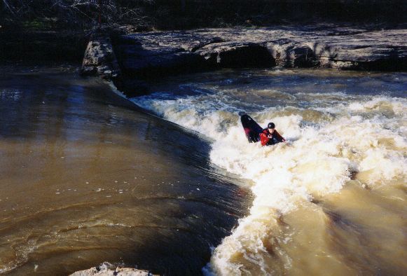
Fred Westrom prepares to insert an end into the put-in old mill dam play hole at big water.
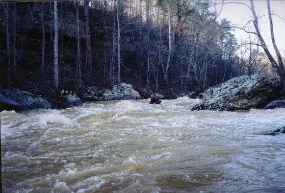
Towards the bottom. maybe there are rocks here at normal water.
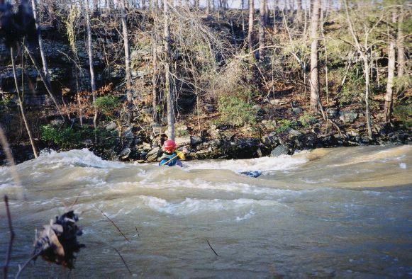
Just above the take-out, there are at least three very cool surfing waves at high water.
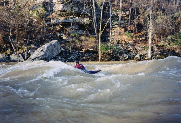
Fred back surfs one of the big waves at the bottom. He later called it "one of the best days surfing ever".