Blue Springs Creek
-
RunBlue Springs Creek
-
ClassII
-
Put InChamblee Mill Rd. (see text)
-
Take OutCR 10 (on Mulberry)
-
Length (mi)2.1, + 2.4 miles on Mulberry
-
Gradient (fpm)30, 60 (1.1)
-
Watershed (mi2)21.7
-
Primary Gage
-
Indicator Gage
none
Description
This little stream drains the opposite side of the ridge from Graves Creek north of Blountsville. It actually has its own gage, probably to see how much sewer water Blountsville can pump into it. The creek starts out and ends up class II with nothing but class II in between. Some decent waves may open up at higher water. Above the bridge it goes over what must be the remains of Chamblees Mill. It has pretty decent gradient but does not do much with it. This would be a nice beginner or mellow water run given recent rains. There are 5-6 logs across the creek as of late 2/2001, but they are all easy walks or scrape-overs.
Blue Springs peaks and falls incredibly fast. We ran it at 60, but 100 would be better. The gage is upstream of the whitewater section on the western edge of Blountsville, so the actual flow where you run it is higher than shown by the gage. It would be hard to have too much water on this. It is probably a good indicator gage for Graves Creek, and may be useful for the Calvert Prong and Blackburn Fork as well. The best place to put in is at the A-frame house where the road above the bridge over the stream curves away from the stream, just as the mini-gorge begins. This adds 0.8 miles to the run, otherwise it is 1.25 miles from the last bridge to the Mulberry. When you run this, the Mulberry will be high but mostly moving flatwater, so it goes by quickly. There are one or two pretty fast and smooth big waves between the creek confluence and the take-out.
Details
-
ClassII
-
Gradient (fpm)30, 60 (1.1)
-
Length (mi)2.1, + 2.4 miles on Mulberry
-
Watershed Size (mi2)21.7
-
Put InChamblee Mill Rd. (see text)
-
Take OutCR 10 (on Mulberry)
-
ShuttleChamblee Mill / CR26 / CR10
-
Water Quality
 (
3 chickens | 1 = Good, 3 = Gross)
(
3 chickens | 1 = Good, 3 = Gross)
-
Primary Gage
-
Indicator Gage
-
Precip. Gage
Map
Video
Photos
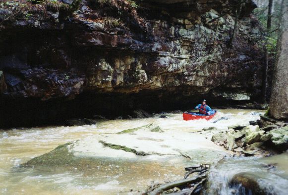
Dave Curry next to a treacherous undercut. Not.
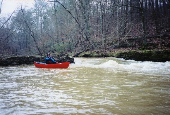
Dave poses next to the remains of what must have been Chamblee's Mill
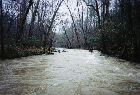
Yep, all the pictures are of Dave. Where is your camera, Dave? "I forgot it"
Trip Reports
Blue Springs Creek
February 22, 2001
Originally from Winter 2000-2001 Exploratory Update
Written by Mark D
Dave Curry, Wade Amis and I ran this after Chitwood. It is just off CR 26, which goes from Blountsville to the Mulberry upper put-in area. It is all class II with nice constant gradient. Recent rain is a must, though it dos have its own gage, probably to check on sewage outflow from the Blountsville plant. There are a few logs. It may have good play at higher water. When you get to the Mulberry, the volume is big and the water moves quickly over the 2.5 miles to the upper Mulberry put-in. One or two big waves can be caught if you are so inclined.